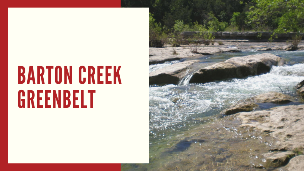
Barton Creek Greenbelt is one of the top trails in Austin and is the most beloved greenbelt by the locals and is commonly referred to as “The Greenbelt”. Barton Creek Greenbelt is one of the city’s most treasured attractions that has 7 entrance points. It is located in the south-central Austin and has 12.68 miles of trails with its main trail that is about 7 miles. It makes it easier for the visitors to access it and enjoy the different facilities the Greenbelt has.
Swimming, biking, bird watching, mountain climbing are some of the activities you can do within the Greenbelt.
This magnificent body of nature is located just a few minutes away from downtown Austin. In this blog, we will be guiding you through the different entrances or access points in Barton Creek Greenbelt as well as the different spots along the way.
TABLE OF CONTENTS
Barton Creek Greenbelt Access Points

TRAIL HEAD
- Location: 2212 William Barton Dr., Austin, TX 78746, in Zilker Park, near Barton Springs Pool. This is the “Trailhead” or eastern start of the Greenbelt.
- Parking: Large paved lot by Barton Springs (free on weekdays; $7 flat fee on weekends/holidays March, September). Fills up on busy days, so arrive early. Additional street parking on Stratford Dr. or nearby, but heed any city signs.
- Hours: Open daily 5 a.m. to 10 p.m. (City of Austin park curfew). No overnight access.
- Amenities: Restrooms and water fountains available at Zilker Park (near the Hillside Theater and Barton Springs Pool). No facilities once you’re on the trail, pack water.
- Trail Access/Ease: Very easy, a flat, wide entry path perfect for beginners, kids, and even strollers. Great for a jog or casual walk. It’s bike-friendly too.
What to Expect: Starting from the Zilker trailhead drops you immediately into nature. Within minutes, the city noise fades into sounds of Barton Creek and rustling trees. This section of trail is mostly flat and shaded, making it an ideal warm-up stretch or a kid-friendly outing. Because it’s so close to downtown, it’s one of the busiest access points, you’ll see families, trail runners, dog walkers, and cyclists especially on weekends. Plan accordingly for crowds and parking delays on Saturday mornings.
SPYGLASS ENTRANCE
- Location: 1601 Spyglass Dr., Austin, TX 78746, behind the Spyglass apartment area, adjacent to the Spyglass/Barton Skyway road end. (Look for the trail sign at the cul-de-sac and the famed Tacodeli restaurant nearby!)
- Parking: Street parking only. You can park along Spyglass Dr. or the small side street, for free, but spaces are limited and in a residential area. Be considerate of driveways and no parking signs. (During off-peak times, Tacodeli’s lot is not officially for trail parking, but some hikers grab breakfast tacos then hit the trail, at their own risk.)
- Hours: Unofficially open 5 a.m. to 10 p.m. (no gate). The trailhead itself is always accessible, but remember you’re next to apartments, keep noise down early/late.
- Amenities: One composting toilet about 0.1 mile from the trailhead on the trail. No water stations. TacoDeli nearby for food/bathroom during business hours.
- Trail Access/Ease: Easy to moderate. The path starts relatively flat, then gently descends toward the creek. Short hike (~5, 10 minutes) to reach the water. Suitable for most, including kids, with a few rocky spots but nothing steep.
What to Expect: The Spyglass entrance is a Greenbelt gem known for a couple of unique perks. First, it’s literally next door to Tacodeli, one of Austin’s favorite taco spots, making it common to see hikers fueling up on breakfast tacos before hitting the trail. Second, as you walk in, you’ll notice natural limestone tubs and slides carved into the creek bed rock, little “jacuzzis” when the water is flowing.
It’s a fun spot for kids (and adults) to splash or slide around when water levels allow. This entrance also provides quick access to The Flats and Campbell’s Hole from the west side of the creek. In fact, Campbell’s Hole is roughly a 0.5-mile hike from here, making Spyglass one of the quickest ways to reach that swimming hole.
BARTON HILLS ENTRANCE
- Location: 1601 Spyglass Dr., Austin, TX 78746, behind the Spyglass apartment area, adjacent to the Spyglass/Barton Skyway road end. (Look for the trail sign at the cul-de-sac and the famed Tacodeli restaurant nearby!)
- Parking: Street parking only. You can park along Spyglass Dr. or the small side street, for free, but spaces are limited and in a residential area. Be considerate of driveways and no parking signs. (During off-peak times, Tacodeli’s lot is not officially for trail parking, but some hikers grab breakfast tacos then hit the trail, at their own risk.)
- Hours: Unofficially open 5 a.m. to 10 p.m. (no gate). The trailhead itself is always accessible, but remember you’re next to apartments, keep noise down early/late.
- Amenities: One composting toilet about 0.1 mile from the trailhead on the trail. No water stations. TacoDeli nearby for food/bathroom during business hours.
- Trail Access/Ease: Easy to moderate. The path starts relatively flat, then gently descends toward the creek. Short hike (~5, 10 minutes) to reach the water. Suitable for most, including kids, with a few rocky spots but nothing steep.
What to Expect: The Spyglass entrance is a Greenbelt gem known for a couple of unique perks. First, it’s literally next door to Tacodeli, one of Austin’s favorite taco spots, making it common to see hikers fueling up on breakfast tacos before hitting the trail. Second, as you walk in, you’ll notice natural limestone tubs and slides carved into the creek bed rock, little “jacuzzis” when the water is flowing.
It’s a fun spot for kids (and adults) to splash or slide around when water levels allow. This entrance also provides quick access to The Flats and Campbell’s Hole from the west side of the creek. In fact, Campbell’s Hole is roughly a 0.5-mile hike from here, making Spyglass one of the quickest ways to reach that swimming hole.

GUS FRUH ENTRANCE
- Location: 2632 Barton Hills Dr., Austin, TX 78704, where Barton Hills Drive dead-ends by a gated entry. Marked as Gus Fruh trailhead (look for the sign and bulletin board).
- Parking: Street parking only, along Barton Hills Dr. and nearby residential streets. It’s free, but very limited. Essentially you park at the curb by the trail sign or wherever you can find space in the neighborhood. This area can become a parking scavenger hunt on weekends. Do not block driveways or fire hydrants, towing is enforced.
- Hours: No gate, so accessible 5 a.m. to 10 p.m. (park curfew) like the rest. Keep noise down early/late as it’s adjacent to homes.
- Amenities: No restrooms or water at this trailhead. There may be a trash can at the trail entrance, but plan to pack out your trash.
- Trail Access/Ease: Moderate. The trail from Gus Fruh descends via a rocky path and some stone steps to the creek. It’s about a 5, 10 minute hike to the water. The path is relatively short but can be uneven, wear sturdy shoes (especially if you plan to explore the climbing walls here).
What to Expect: The Gus Fruh entrance leads you into a particularly beautiful stretch of the Greenbelt known for its swimming hole and rock climbing walls. At the bottom of the access trail, you’ll find the Gus Fruh Pool, a wide section of Barton Creek that looks almost like a small lake when it’s full. There’s often a rope swing hanging from a tree, and on hot days you’ll see locals taking turns plunging into the water.
LOOP 360 ENTRANCE
- Location: 3753 S. Capital of Texas Hwy (Loop 360), Austin, TX 78704. This trailhead is on the northbound side of Loop 360, just after the highway crosses Barton Creek (near MoPac). It’s tucked at the edge of an office park parking lot, look for the “Greenbelt Access” sign by the turn-in.
- Parking: Dedicated trailhead parking lot, gravel/packed dirt surface, free of charge. It’s essentially a section of the office complex’s lot designated for Greenbelt users. The lot isn’t huge and can overflow on popular days. If full, do not park in the private office spots during business hours (you may be towed). Instead, some overflow parking is allowed along the highway shoulder north of the lot (check for signage).
- Hours: Officially open 5 a.m., 10 p.m. (city park hours). The lot is not gated, but the office park might have security patrols after hours. No overnight parking.
- Amenities: Composting restrooms at the trailhead, a big plus! There’s usually at least one trail map kiosk and a trash can as well. No water fountains, so bring your own.
- Trail Access/Ease: Easy to moderate. The Loop 360 entrance is often called the easiest access on the Greenbelt. The trail here has gently sloping switchbacks down into the canyon, rather than a steep drop, making it manageable for most fitness levels. It’s a smooth dirt/gravel path at the start. Great for trail running and mountain biking.
What to Expect: Loop 360 is a very popular access point because it’s central to many of the Greenbelt’s highlights. From this mid-trail hub, you can head east (downstream) toward Gus Fruh and Zilker or west (upstream) toward Twin Falls/Sculpture Falls. The trail is well-marked and wide here, with a steady stream of hikers, runners, and bikers. Don’t be surprised to see folks in full mountain bike gear, this area is sometimes nicknamed the “Barton Creek Bike Trail” for its biker-friendly terrain.
GAINES CREEK | TWIN FALLS ENTRANCE
- Location: 3918 S. MoPac Expressway (Loop 1), Southbound Service Road, Austin, TX 78746. Commonly called “Twin Falls trailhead,” it’s where the MoPac frontage road meets a small parking area just south of Loop 360. (If you’re coming down MoPac/Loop 1 southbound, take the exit for Loop 360, then continue straight on the service road, trail parking is on the right.)
- Parking: Limited roadside parking on the MoPac service road. It’s free, basically parallel parking on the gravel shoulder. There’s no formal lot; you just angle in wherever there’s space. This fills up quickly on weekends by late morning. Do not park on the main highway! , only on the service lane. Watch for any “No Parking” signs and ensure your car is completely off the roadway.
- Hours: No restricted hours, but the area is dark at night and not recommended after 10 p.m. (Plus, the neighborhood across the creek, Gaines Ranch, might report after-hours activity.) Stick to daylight or early evening.
- Amenities: No restrooms or water at this trailhead. It’s pretty much just an access point with a trail kiosk. Pack in water and pack out trash.
- Trail Access/Ease: Moderate. From the road, the trail drops down a rocky hill and then levels out alongside the creek. Initial descent is a bit steep and rocky, so mind your footing. After that, it’s a fairly easy hike along the creek bed to reach the falls. Expect ~1.2 miles of hiking to get to the furthest feature (Sculpture Falls), with Twin Falls coming up sooner.
What to Expect: The Gaines Creek trailhead is your gateway to two of the Greenbelt’s crown jewels: Twin Falls and Sculpture Falls. This is one of the most popular sections of the entire trail because of those beautiful cascading waterfalls and swimming holes. From the parking area, you’ll hike in about 10, 15 minutes to reach Twin Falls, the first small waterfall. True to its name, Twin Falls usually features a double-stream of water pouring over limestone ledges into a shallow pool.
It’s a lovely spot to snap photos or wade (the pool is often only waist-deep). In another 10, 15 minutes beyond that, you’ll arrive at Sculpture Falls, which is a larger waterfall and deeper swimming hole. Sculpture Falls is an “urban oasis”, clear, cool water (around 70°F in summer) that’s perfect for beating the Texas heat.
TRAIL END
- Location: 1712 Camp Craft Rd., West Lake Hills, TX 78746. This is the “Trail’s End” access at the far western end of the Greenbelt. It’s in a residential area of West Lake Hills, near Westlake High School’s athletic fields. Look for a small trailhead sign by the road and a gate.
- Parking: Roadside street parking on Camp Craft Rd., and note, it is paid parking in this area. The City of West Lake Hills has instituted a paid parking zone from 8 a.m. to 8 p.m. daily for trail users. Look for a kiosk or signs with QR codes to pay (as of 2024, it’s often via a mobile app or pay station, around $2 per hour or $6 for the day, check current rates). They do ticket/tow if you don’t pay during enforced hours. There are a handful of parallel spots near the trail gate and additional shoulder parking further up Camp Craft. Alternatively, some people park in the nearby shopping center or school lot when those are empty, but do so at your own risk/after-hours.
- Hours: Technically dawn to dusk (city park rules), and West Lake Hills police do patrol. Definitely avoid being here late at night; the area is very dark and the neighborhood is sensitive to noise.
- Amenities: Compost toilets are located about 0.05 miles down the trail from the entrance (near the base of the hill). No water fountains. A trail map kiosk is usually at the top.
- Trail Access/Ease: Strenuous. This is the famous “Hill of Life” access, named for the steep 300-foot hill you must descend (and later climb back up!) to use this entry. The trail is a rocky, eroded jeep-road type path. Going down is a bit hard on the knees; coming up is a leg-burning workout. Not recommended for young kids or anyone not prepared for a steep hike. Mountain bikers love this challenge, so expect fast bikes on this section.
What to Expect: Trail’s End is literally the end (or beginning, depending on perspective) of the main Barton Creek Greenbelt trail. It’s most famous for the Hill of Life, a half-mile stretch of steep switchbacks that will definitely get your heart pumping. Many local runners and cyclists use this hill for training, you might see people doing repeats for exercise (more power to them!). If you start here, you’ll hike down the Hill of Life to reach the creek.
At the bottom, you’ve entered the Barton Creek Wilderness Park area, a more remote feeling part of the Greenbelt.
Spots to Visit in The Greenbelt
CAMPBELL’S HOLE
One of the famous swimming holes in Austin is just a few minutes away from downtown! You can access it from the Spyglass entrance or the Barton Hills entrance. The pool gets deep after rainfall and also gets packed during the afternoon.
THE FLATS
A nice place to relax, and unwind under the shady trees. The swimming hole is close to downtown and an easy hike away from the Spyglass entrance. It’s very easy to hike that you don’t need to bring any gear when you visit. The water is ideal on hot days but low if it doesn’t rain for a while.
GUS FRUH
Most swimming holes in Barton Creek are dependent on rainfall, so if it hasn’t rained for a while, there might not be enough for swimming. Gus Fruh is another popular swimming hole within The Greenbelt that locals love because of its lake impression. Use the Barton Hills access point and follow the trail down the stream to find this urban treasure.
GUIDE’S WALL
If you are a beginner starting out climbing in the wild, Guide’s Wall is a wall that is right for you. It is a short limestone often used by guides and beginners.
URBAN ASSAULT
Urban Assault is the highest wall in The Greenbelt. It is a chossy limestone wall that is approximately 90ft high and located on open ben in the creek. It does get hot during summer and few visitors try and visit the climbing the area.
SEISMIC WALL
One of the several climbing locations in Barton Creek Greenbelt and is also known as Maggie’s Wall. It is appealing to visitors because of its short and easy approach. There are also lots of moderate routes as you climb! Although it might be impossible to climb barefoot because of how polished the rocks are, so you better be ready with your climbing shoes and gear when you head out here.
TWIN FALLS AND SCULPTURE FALLS
How long is the hike to Sculpture falls? It’s about 1.2 miles or at least 30-45 minutes away by walking the rail to reach the area. Sculpture Falls in a hidden gem within The Greenbelt and considered an urban oasis. One of the greatest ways to beat the Texas heat because of the water temperature reaching 70 degrees! It’s the perfect spot during summer. Don’t forget not to go barefooted since the rocks are often slippery.
HILL OF LIFE
The Hill of Life is another popular spot in The Greenbelt that is best to work on your mountain biking skills as well as running and hiking for its steep uphill and downhill section. Another Barton Creek Bike Trail that is loved by mountain bikers. The gorgeous area features wildflowers and trees on the sides. Aside from this area, the entire Barton Creek Greenbelt is dog-friendly.